Flood Prediction
The Flood Prediction page displays real-time flood forecasts powered by the Google Flood Forecasting API. It provides early warning data for river gauge…
The Flood Prediction page displays real-time flood forecasts powered by the Google Flood Forecasting API. It provides early warning data for river gauge stations and flash flood events globally, helping response teams identify developing flood situations before they become emergencies.
Understanding the Data
Flood prediction data comes from three source types:
- Gauge — River gauge station readings with current and forecast water levels
- Flash Flood — Flash flood forecasts for specific locations based on rainfall modelling
- Significant — Significant flood events identified by Google's forecasting system
Each forecast entry includes a severity classification and a trend indicator showing whether conditions are improving, stable, or worsening.
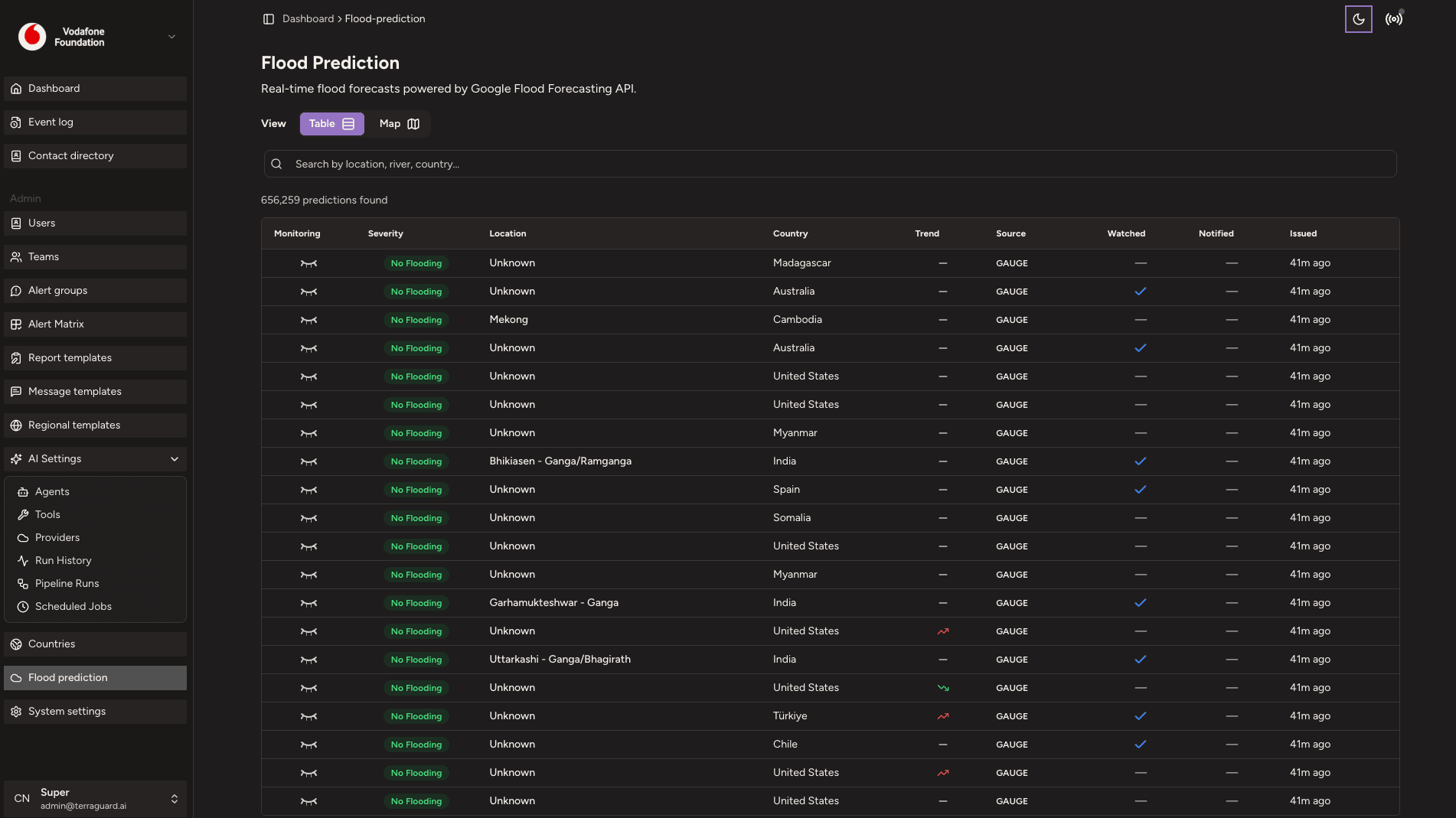
The Flood Prediction Table

The table displays all current flood forecasts with the following columns:
- Monitoring — whether the forecast is being actively monitored (click the eye icon to toggle)
- Severity — colour-coded severity badge (from Google's classification)
- Location — gauge or river name (click to open the detailed forecast view)
- Country — the country where the forecast applies
- Trend — directional icon showing whether the forecast is improving or worsening
- Source — the forecast source type (Gauge / Flash Flood / Significant)
- Watched — indicates whether this location falls within one of your organisation's configured countries
- Notified — whether a notification has been sent for this forecast
- Issued — when the forecast was issued
Filtering Flood Predictions
Use the filter controls to narrow forecasts by severity, country, source type, and keyword search. You can also sort by any column. Switch between the Table view and Map view using the view toggle to see forecasts plotted geographically.
Flood Prediction Detail
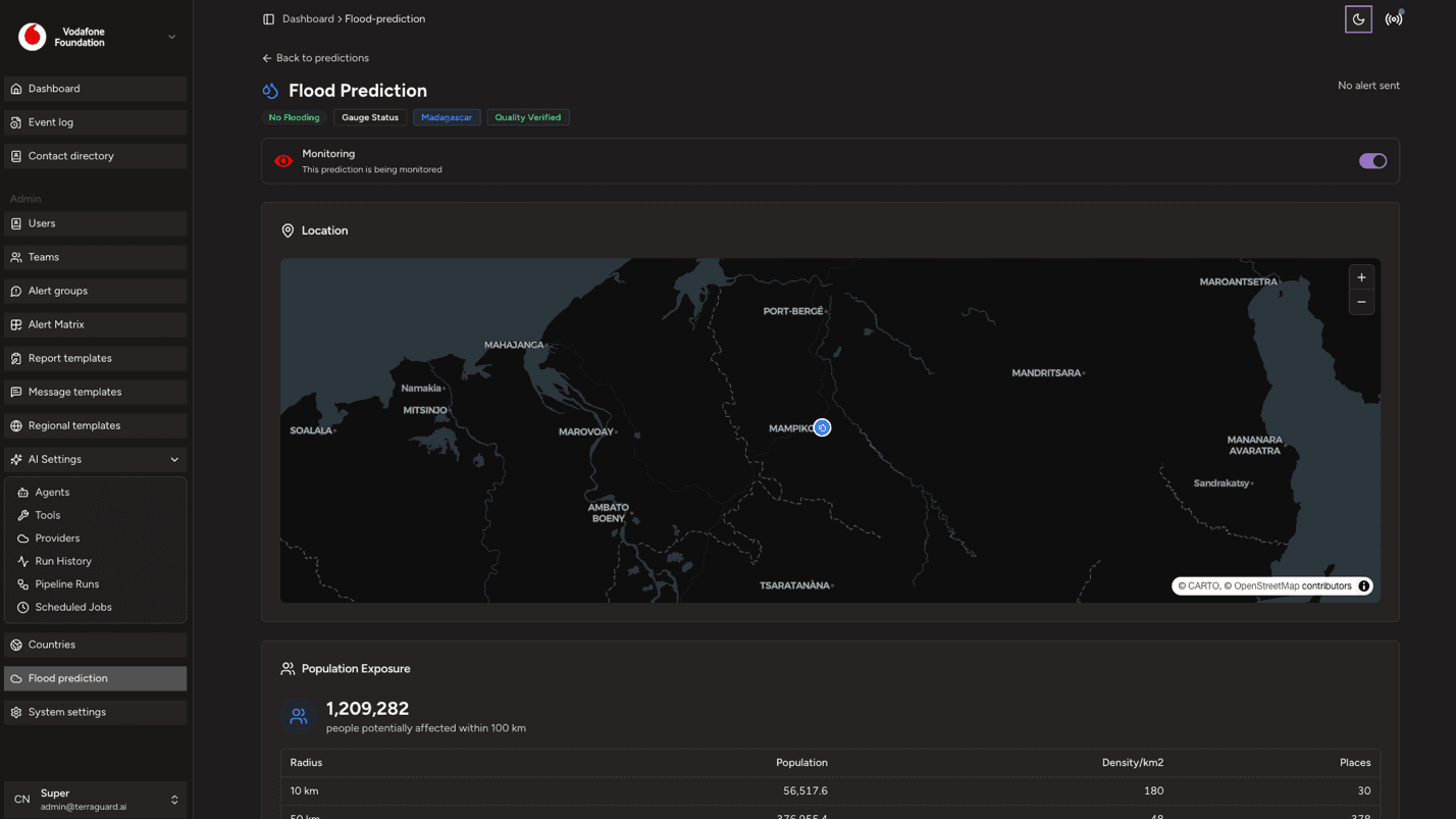
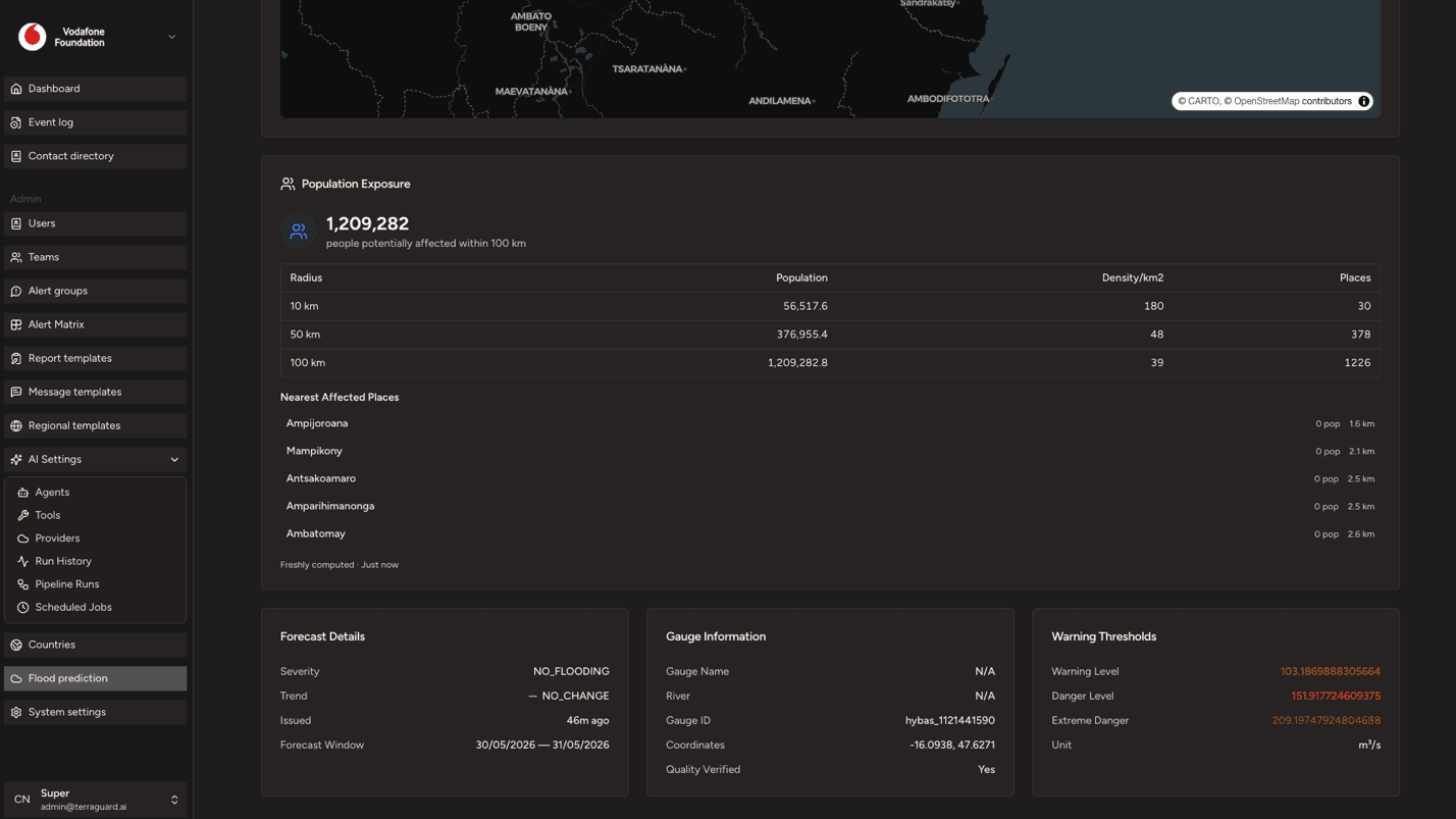
Click any location name to open the detailed forecast view. This shows the full forecast chart with predicted water levels over time, alongside the gauge's historical readings and any additional metadata from the Google Flood Forecasting API.
Admin: Countries
The Countries page allows Managers and Admins to configure country-level partnership settings, deployment likelihood, and contacts for their organisation.…
Settings: General
The General settings page allows Admins to configure organisation-wide settings. It has three tabs: General, Filter Configurations, and Service Health.